Jakarta, December 2, 2025, PT Agincourt Resources (PTAR) extends its deepest condolences and sympathy to the families of all victims affected by the recent flash flood and landslide disaster in Batang Toru Sub-district, South Tapanuli. Our thoughts and prayers are with the victims, their families, and all the communities impacted by this tragic event. We continue to mobilize all resources to ease the burden on the affected communities.
In response to certain recent media coverage/reports, PTAR wishes to provide a review of the narrative that links the disaster in South Tapanuli to the Martabe Gold Mine operations.
Our review finds that directly linking the operations of the Martabe Gold Mine to the flash flood incident in Garoga Village is a premature and inappropriate conclusion at this time. Based on verifiable data and direct facts gathered from the field, the flash flood and landslide disaster event can be preliminarily explained as follows:
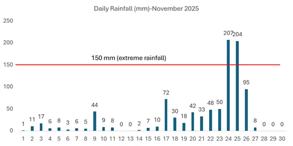
- The disaster was immediately preceded by the influence of the Senyar Cyclone, which generated rainfall of extremely heavy intensity across the South Tapanuli region. Based on statistical analysis, this rainfall volume was so extraordinary (refer to Figure 1 for data comparison) that represents a maximum rainfall event that has not occurred for at least the last 50 years. This exceptional volume of precipitation fell uniformly across a vast area of Northern Sumatra, critically impacting the Batang Toru Forest area. The Batang Toru Forest serves as the upstream headwaters for the primary rivers flowing through the Batang Toru Sub-district, including the Garoga River (Aek), Aek Pahu, and the Batang Toru River itself.
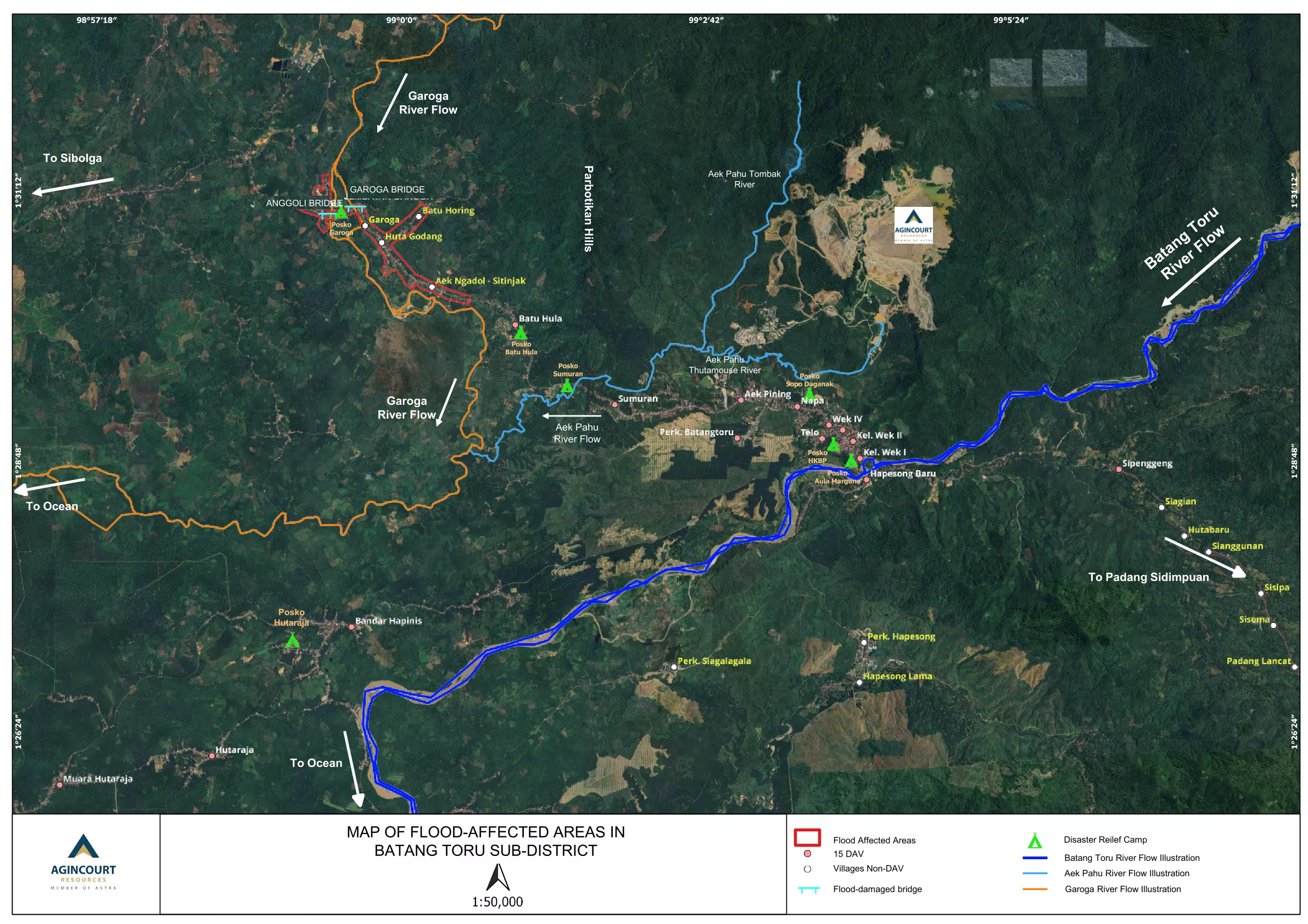
- The flood disaster originated primarily in Garoga Village, which lies within the Garoga Sub-Catchment Area (DAS). From this initial location, the disaster spread to several neighboring villages, including Huta Godang, Batu Horing, Sitinjak, and Aek Ngadol (see Figure 2, area inside the red box).
- The flash flood disaster occurred when the Garoga River (colored orange in Figure 2) channel was unable to accommodate the high volume of floodwaters. This condition was triggered by the massive blockage of log materials accumulating at the Garoga I Bridge and the Anggoli Bridge (Garoga II). The blockage reached a critical point on November 25, at approximately 10 a.m., causing a sudden and catastrophic change in the river’s path. This change forced two Garoga tributaries to merge into a powerful, single new current that directly struck Garoga Village.
- PTAR operation is located within the Aek Pahu Sub-Catchment Area, which is defined by the Aek Pahu River (Figure 2, light blue). Hydrologically, this area is separate and distinct from the Garoga Sub-Catchment Area upstream of Garoga Village. Although the two rivers eventually meet, their confluence is significantly far downstream of Garoga Village, with the combined flow continuing toward the west coast of Sumatra. Consequently, the mining operation has no effect on the upstream area of the Garoga River.
- Although several landslide events were observed within the Aek Pahu sub-Catchment Area, the Aek Pahu River flow did not experience a flash flood phenomenon. In contrast with the Garoga River, the Aek Pahu river lacked the intensive input of mud and logs that typically causes massive blockages and triggers flash floods. Consequently, the fifteen (15) villages surrounding the mine, which are predominantly situated in the Aek Pahu sub-Catchment Area, experienced no significant impact. These villages are currently functioning as local evacuation centres.
- Aerial observation via helicopter in the upstream area of the Garoga River strongly reinforces the hypothesized source of the mud and logs: Riverbank failure resulting from landslides triggered by oversaturation and seismic events. At the observation point within the Garoga sub-Catchment Area, visual evidence documented massive landslides along the river channel banks, including within the protected forest area. These slides are identified as the direct source of the bulk of the mud material and logs found in the Garoga River. While this finding provides a strong initial indication, further comprehensive study is required to fully investigate and confirm all major contributing causes.
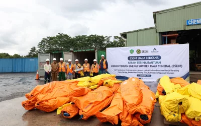
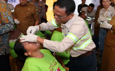
- PTAR immediately acted as one of the first responders, contributing to crucial Search and Rescue (SAR) activities and establishing critical access. Our efforts included opening access routes and setting up evacuation posts equipped with emergency tents, public kitchens, and community clinics. Since the first day of the disaster, we have continued to mobilize all necessary resources, working in close coordination with the regional government, TNI-Polri (Indonesian Armed Forces and Police), and other stakeholders. This joint effort is essential for minimizing the number of victims and maximizing the speed and efficiency of post-disaster recovery efforts to ease the burden on community.
- As an integral part of the Batang Toru and South Tapanuli community, PTAR operates under strict adherence to all applicable regulations, particularly those concerning environmental protection and permitting. The Martabe Gold Mine conducts all mining activities exclusively within Other Use Areas (APL), outside the designated forest area. Throughout its operations, PTAR demonstrates an unwavering commitment to environmental stewardship, actively supporting conservation efforts related to water, air, and soil, and advancing biodiversity conservation in collaboration with both national and global institutions.
Fully understanding the significant public concerns and attention on this disaster, we urge all parties to prioritize collaboration, clear communication, and accurate information management. We continue to fully support the execution of a comprehensive and independent study of the disaster as its findings are vital for formulating effective future disaster risk mitigation strategies.